Maryland hail map — July 5, 2026
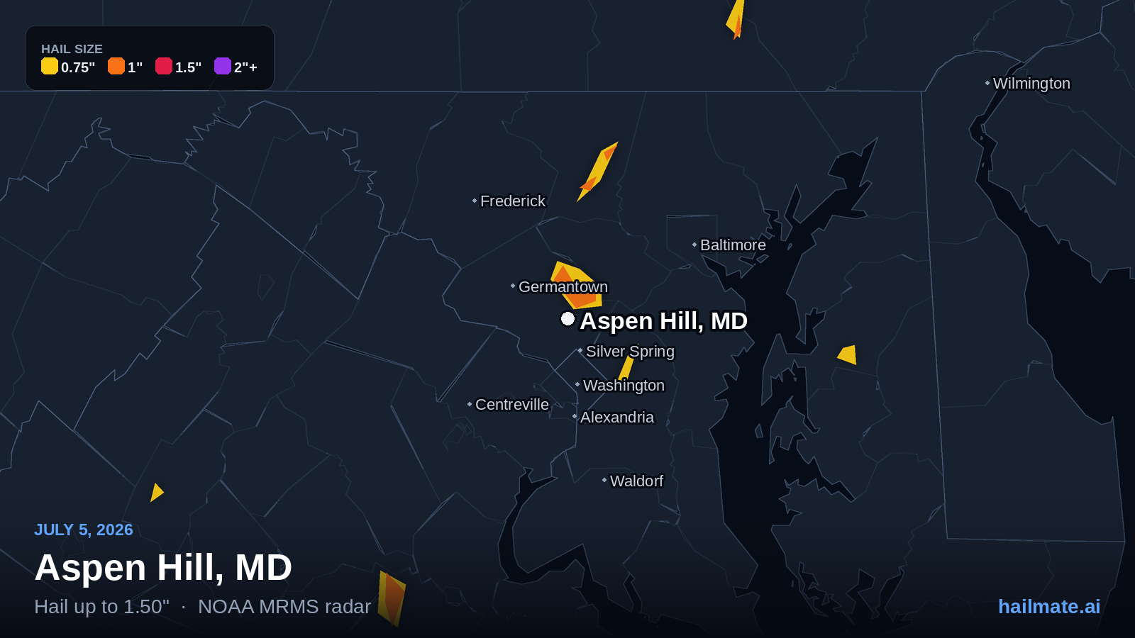
NOAA radar detected hail of an inch or more over 19 Maryland cities on July 5, 2026. The largest stones — 1.50″, half dollar size — fell over Aspen Hill.
Claim your live interactive hail map
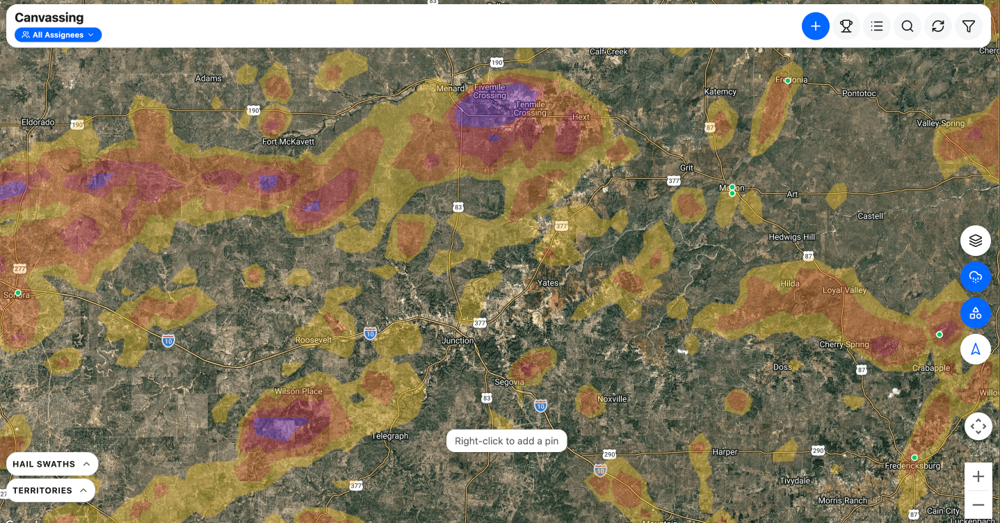
Every address in Maryland at once — three years of NOAA hail swaths drawn on a map you can zoom, filter and actually work.
$79/moall of Maryland, not one storm day
- The July 5, 2026 swath — and every other storm since 2023 across Maryland
- GPS door-knocking — pins, photos and who you have already hit
- Jobs, contacts, estimates and invoices included
- An alert the next time Maryland gets hit
HailTrace charges $229 for this one day, once. $79 here is all of Maryland, every day.
- Cities hit
- 19
- in Maryland
- Largest stone
- 1.50″
- half dollar size
- Impact rating
- 5/10
- from stone size
Sizes come from NOAA radar, which runs about ±0.25″ against ground truth. It is canvass-targeting quality, not claim evidence.
Did hail hit your address?
This page covers Maryland as a whole. Check your own address to see every storm on record for your roof — the date and the stone size for each one — and we'll email you the full report to keep.
Check my addressFree, and no account needed to look it up. If hail did hit, you'll have the date and the stone size in writing — which is the first thing an adjuster asks for.
Maryland cities hit on July 5, 2026
What people on the ground measured in Maryland on July 5, 2026
5 reports filed with the National Weather Service — 3 from trained observers or officials. These are measured stones, not radar estimates, so they are the closest thing to proof that hail actually reached the ground.
- 1.25″ half dollar size Public3 SW Hampstead, MD7:16 PM EDTCarroll County
About a dozen trees snapped and uprooted at a residence in the 300 block of Paper Mill Drive. Also observed half dollar size hail. Numerous trees down in the area from likely significant downburst.
- 1.00″ quarter size Trained Spotter1 WNW Finksburg, MD7:00 PM EDTCarroll County
- 1.00″ quarter size Trained Spotter1 SSE Reese, MD7:07 PM EDTCarroll County
- 0.75″ penny size Trained SpotterHampstead, MD7:28 PM EDTCarroll County
- 0.75″ penny size Public1 N Perryville, MD10:07 PM EDTCecil County
Report from mPING: Dime (0.75 in.).
Reports come from the National Weather Service Local Storm Report feed, ingested every 15 minutes. A report records where the observer was, not the full extent of the swath — treat it as evidence about the storm, not about any one roof.
Other states hit on July 5, 2026
Other Maryland hail days
Shopping for a hail app to work Maryland?
This page is one storm. If you are deciding which tool to work Maryland with all season, these compare the ones roofers actually buy — with every price taken from the vendor's own site and linked.
- Best hail tracking apps, comparedHailMate, HailTrace, Hail Recon, HailStrike and RadarScope — every published price sourced and linked, and who each one is genuinely right for.
- HailMate vs HailTraceStreet-level NOAA swaths on a map your crew can knock, with the CRM already inside — instead of quote-only meteorologist maps billed on top of one.
- Hail map apps for roofers (and the Hail Recon alternative)Every storm on one map instead of loading dates one at a time — plus the canvassing and the whole claim, monthly, for what one state costs them a year.
- Best canvassing apps, comparedHailMate, SalesRabbit, SPOTIO, Knockio, RoofLink and Badger Maps — every published price sourced and linked, and two of them publish none.
Maryland hail on July 5, 2026
NOAA radar put hail of an inch or more over 19 Maryland cities that day. The largest stones — 1.50 inches, half dollar size — were over Aspen Hill. Every city hit is listed above with its own stone size.